We found the Pusch Peak via Linda Vista Loop Trail on our Alltrails App. It was close to our campground so we decided to give it a try. The Linda Vista loop is 2.2 miles and it is a very easy trail.
At about the 1.1 mile point in the trail there is a spur trail, which is the Pusch Peak trail. It is not marked so you need to be on the lookout for it. This trail takes you to the top of the mountain. The Pusch Peak trail was steep and narrow with a total gain of 2000 feet in 1.5 miles. I wouldn’t climb this trail if you have a fear of heights, aren’t sure footed or have health issues. It is pretty steep. The trail is not marked but it clearly is a trail so you won’t veer off and get lost. The trail ends between the small hump and the larger hump on the right side of this photo. The ravine runs along the the side of the trail.
Can I make it? Yes I did.
I slid down the rock on the way back just like my 1 year old granddaughter goes down stairs.
This is a great view of the top of an outcropping, whose peak was about 2/3 of the way up the trail.
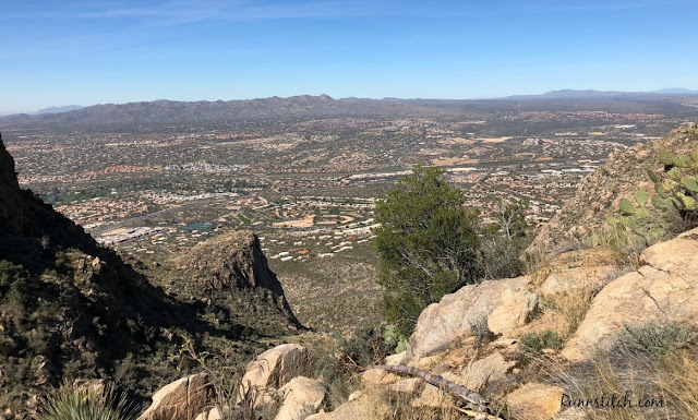
And a view from beside the same outcropping with Tucson below
I wish I had a better camera for this shot of a rare sighting of the Magnificent Hummingbird. This is a male bird. It looks black but the feathers are actually a dark green.
According to the Alltrails app there is plenty of parking, however we found this not to be true. There was a very full, smaller parking lot when we arrived at around 11AM. We had to wait for people to leave to get a spot. When we returned to our truck at about 2:30 in the afternoon, there were open parking spaces. I would recommend going early or later in the day if you want parking.


No comments:
Post a Comment